Larapinta
The Larapinta Trail was the brainchild of Alan Ginns, who was a National Park planner with the Conservation Commission of the NT in Alice Springs from 1982 to 1996. The Larapinta trail was a key component of the concept for the West MacDonnell National Park, also one of Ginns’ initiatives.
In the 1980s the Northern Territory’s national parks were small, disconnected reserves along the West MacDonnell Ranges.
That all changed when Alan Ginns — a senior planner from the NT conservation commission — was tasked with putting together a proposal to link the parks using federal funding. In 1988 the Larapinta Trail was born.
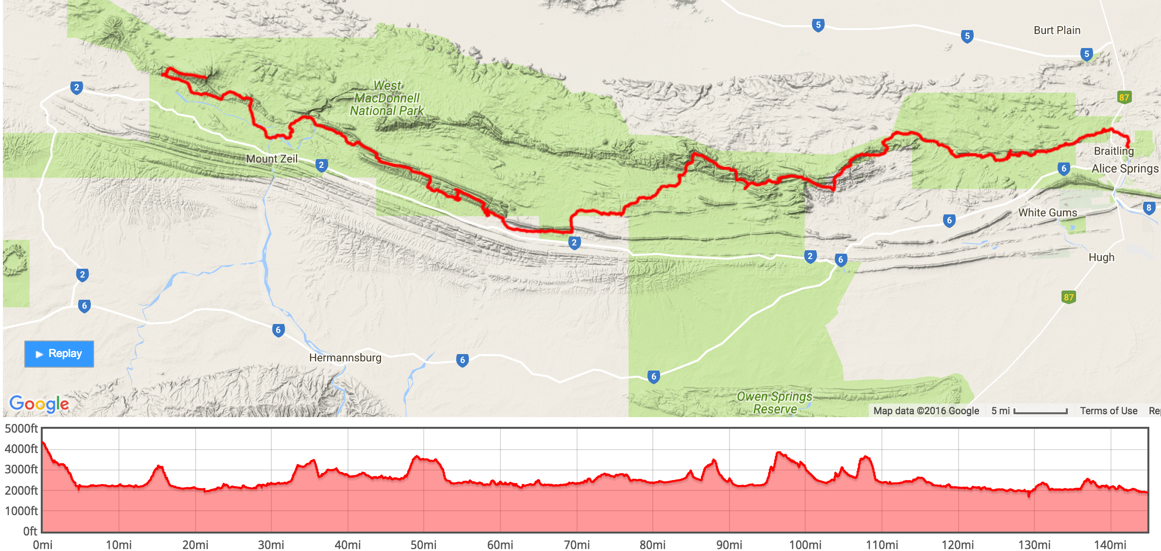
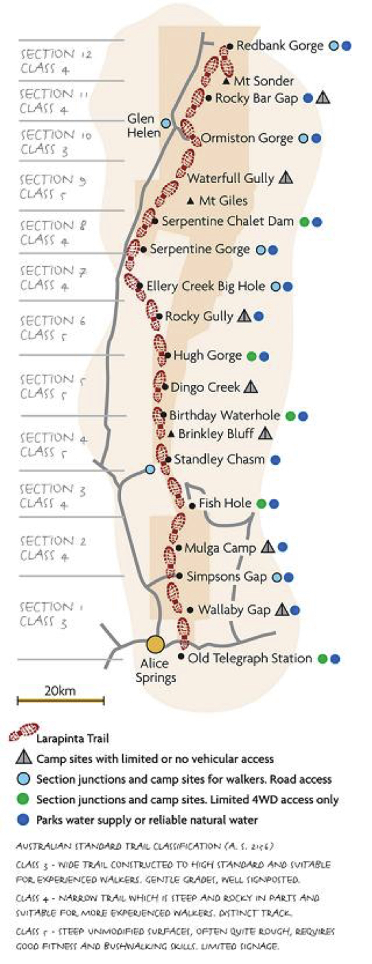
Ranked as one of the planet’s top 20 treks, the Larapinta Trail is a 231-kilometre path that follows the rocky spine of the West MacDonnell Ranges from Alice Springs Telegraph Station to Mount Sonder.
The long walk in the desert A demanding track carved out of the landscape with the help of prison labour, the Larapinta Trail has come a long way from its humble yet harsh beginnings.
The Larapinta Trails 12 sections have been opened progressively since 1989.
The entire track was officially opened in 2002. The Larapinta Trail planners strove to make the most of the terrain and its spectacular viewpoints. The track spends roughly equal time in each of the West Macs’ main components, the Chewings Range and, more or less parallel to the south, the Heavitree Range.
Throughout the walk, views from one range are greatly enhanced by the proximity of the other. The ranges are linked by the 31 km Section 6, which crosses the Alice Valley. The Larapinta trail began as an idea to link, via walking tracks, the popular visitor areas in the west MacDonnell Ranges such as Simpsons Gap, Standley Chasm and Ellery Creek. These places are roughly one to two days apart and have vehicle access, so the idea was that the trail could be done either as a series of shorter walks, or as a multi-day epic.


